Shore study one
A municipal pier over a hard-working beach
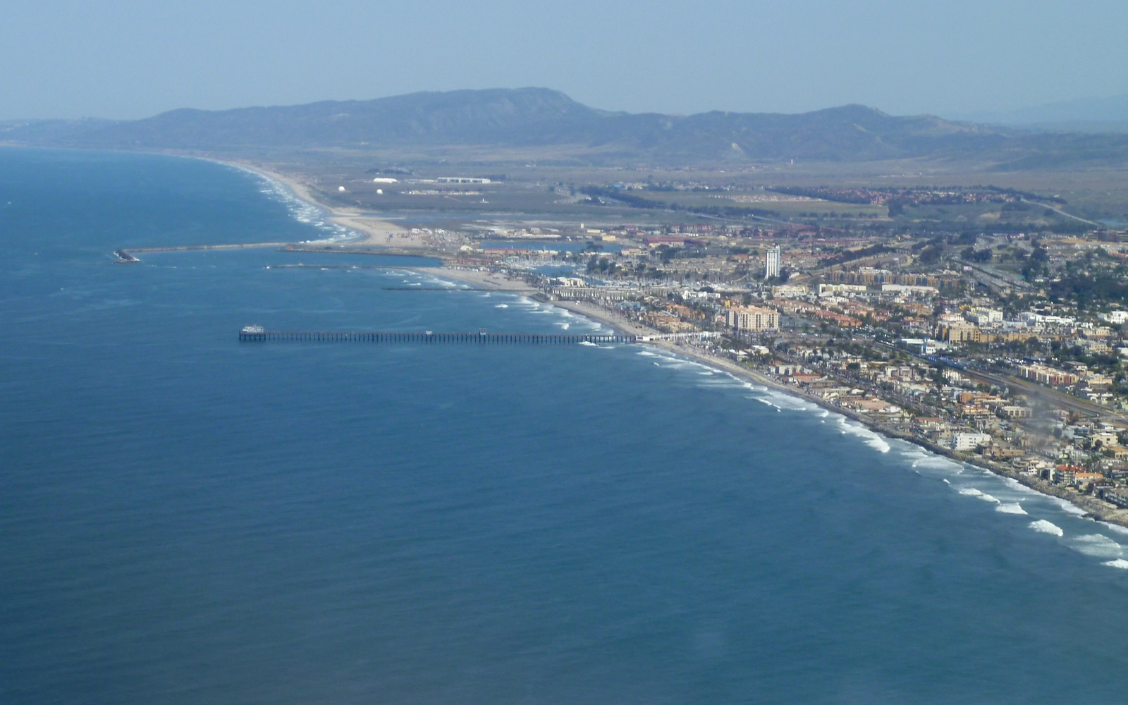
Oceanside holds roughly three miles of Pacific shoreline between Marine Corps Base Camp Pendleton and the city of Carlsbad, and the municipal pier is the landmark that organizes the rest. In its Local Coastal Program grant application to the California Coastal Commission, the city describes a waterfront lineup it calls unique in north coastal San Diego County: the pier itself, a beachfront amphitheater beside it, a small-craft harbor at the north end, and a public road that runs directly on the beach between Breakwater Way and Wisconsin Avenue.
The same application records how hard that shoreline works. The city estimated 5,360,000 visits to its beaches in calendar year 2015, a fourteen percent increase over the year before, with people arriving by automobile, train, bus, boat, and bicycle through one of the better multi-modal networks on the southern California coast. Surfing anchors the culture: the document plainly calls the city a destination for surfers from around the world, drawn by some of the most consistent breaks in the region.
The blocks around the pier keep absorbing civic attention. The application lists freshly renovated waterfront restrooms and a planned cluster of public improvements just south of the amphitheater — a new beach facilities building, more restrooms, a police substation set inside an existing historic structure, and a landscaped plaza — all intended to make the beach around the pier easier for residents and visitors to reach and use.
The record is just as candid about pressure. Much of the sand the Santa Margarita River would otherwise deliver is intercepted by the Camp Pendleton boat basin and Oceanside Harbor, and replenishment efforts have shown mixed results as sand migrates off the beach during storms. The city’s three coastal watersheds — the San Luis Rey River, Buena Vista Lagoon, and Loma Alta Creek — have each produced local flooding in major storm events, and the application asks directly how the pier-area amenities will withstand coastal hazards worsened by sea level rise.
Read together, the two halves of that record say something useful: a shoreline can be beloved and stressed at once. Living near this beach means living alongside the variables the planners catalog — storm-driven water, moving sand, and an ocean indifferent to lot lines. None of that decides what any single address pays for coverage, and no landmark determines address-level risk. It simply points at the questions worth asking precisely.
The most practical of those questions concerns water. Standard California homeowners policies typically exclude flood, mudslide, and debris flow, and separate federal flood coverage ordinarily takes effect thirty days after purchase — timing that rewards reading contracts before a forecast turns. A pier-adjacent household weighing that gap can start with the state insurance department’s flood overview, then ask an agent how a specific policy defines water damage, wind damage, and the boundary where they meet.
City record: City of Oceanside Local Coastal Program grant application (California Coastal Commission). Insurance reading: California Department of Insurance flood overview.